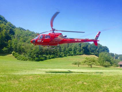
 To hold time constant and capture spatial variation, we collaborated with the Institute for Applied Plant Biology during their canopy sampling campaign, which is carried out by helicopter.
 How do we know that what we observe at one location holds true at another?
For the past three years, my collaborators and I have been studying the spatial patterns in stable isotopes of water as they move through forest ecosystems. My hope was that looking at variations in space would reveal something variations in time cannot – the application of stable isotopes water to ecohydrology has long been focused on repeatedly sampling the same location. The first three papers are now a matter of public record, largely thanks to the efforts of Scott Allen, Sabine Braun, James Kirchner and Rolf Siegwolf, with a few more papers on the way.
I had hoped that we would gain some fundamental insights into process. For instance, can sampling spatial variation in soil water isotopes tell us more about how soil characteristics contribute to variation? However, what has captured my attention is very different:
-Many applications of stable isotopes of water benefit from spatially and temporally explicit estimations of precipitation inputs. Interpolated maps of precipitation isotopes have become a fundamental tool. In a paper published in Geophysical Research Letters, Scott Allen develops a method using sine curve functions to describe the temporal patterns in precipitation isotopes across the entirety of Switzerland, then maps each of the three sine curve parameters (amplitude, phase, and offset). Each parameter contains compelling information: amplitude describes the strength of the seasonal cycle, phase describes the timing of the peak values, and offset describes the mean values. Beyond the many existing applications of precipitation “isoscapes,” I cannot wait to see how the community uses this new information.
-For a long time, we have been using variation in stable isotopes of water in the soil and comparing it to stable isotopes of water in plants as a means of inferring something about the depth of plant water uptake. In a paper in Hydrology and Earth Systems Sciences (currently in open review), Scott Allen develops a new index of plant source water that I believe much more accurately reflects what we are measuring – the seasonal origin of the water being taken up by plants. This approach is agnostic to the current debate about the methodological concerns of soil water isotope extraction. Moreover, I am hoping that it will reframe and advance the field in new directions. This is not to say that the results of the study– over 900 trees at 182 sites across the entirety of the country of Switzerland –are not incredibly compelling in and of themselves….
-At the beginning of this post, I posed a question. How do we know that what we observe at one location holds true at another? How do we know that the soil water isotopes sampled in one location are similar to those 5 m distant, 50 m distant, or 500 m distant. This is of critical import because we frequently use soil water isotopes sampled at one location as the foundation for inferring the depth of root water uptake among any number of neighboring trees. On average, studies have sampled 4 replicate individuals of 3 different plant species and matched them with 3 replicate soil profiles (n = 76 studies from 2010-2016; Evaristo & McDonnell, 2017). We hope that those 3 soil profiles are representative. In a study I led in the journal Ecohydrology, we demonstrate that accurately characterizing the spatial variation (both lateral and vertical) in soil water isotopes requires considerable sampling. Our simulations show that due to tremendous variability, inferences of root water uptake using two-end member mixing models (or really most of the methods reviewed in the compelling paper by Rothfuss and Javaux 2017) cannot be interpreted with confidence at our temperate forest site. We will have to hold ourselves accountable for this while interpreting research carried out to date and in designing new research in the future.
As always, I invite your comments and feedback. Many thanks to all of the individuals who have contributed to this research, the funding agencies that have made it possible, and the reviewers and the handling editors who have helped us effectively communicate it.
 RSS Feed
